1st challenge #
Take a screenshot of the landscape and reverse-search it using a tool like https://addons.mozilla.org/en-US/firefox/addon/search_by_image
You directly find the name of the place, and then it’s just a matter of moving along the road to get the exact spot
2nd challenge #
There’s a local fast food shop that can be reversed the same way
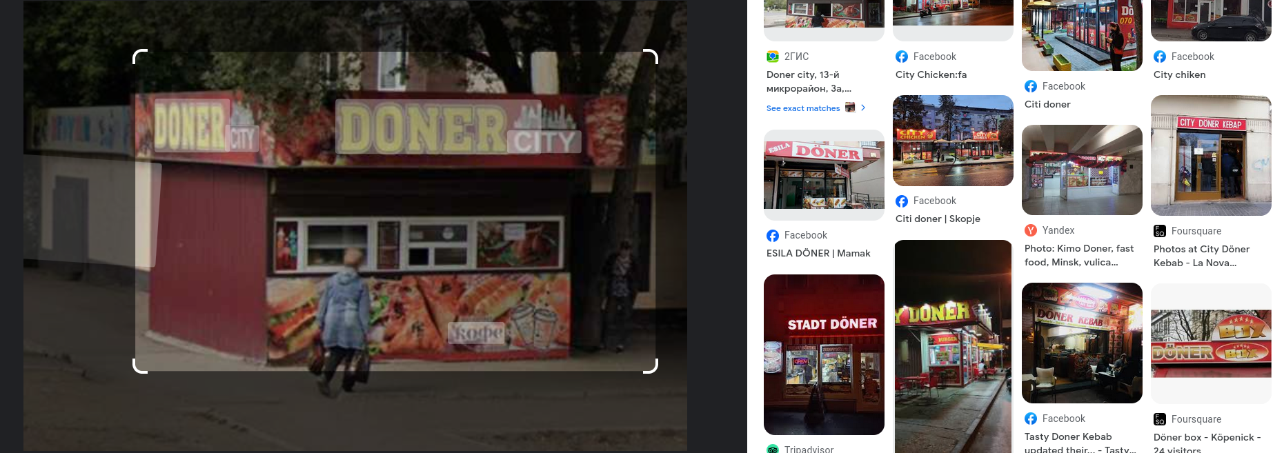
Then you just look it up online.
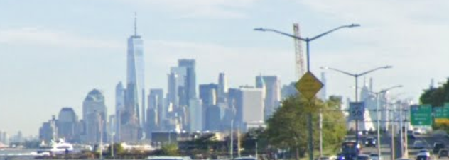
3rd challenge #
This is a picture in Taiwan since the traffic lights are typical of it (https://geohints.com/TrafficLights)
The normal way would have been to use this indication :
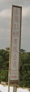

When searching for 李連資源科技股份有限公司 you immediately find the place since there’s only one in Taiwan.
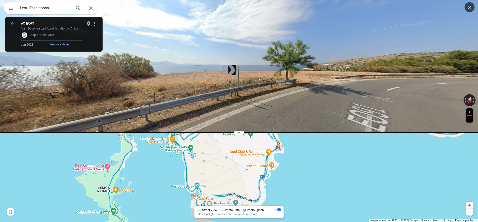
4th challenge #
This definitely looks like Greece, Athens given the fact there’s a bay right next to the road and that reverse searches on the mountain at the back of the city show it is in the area. But apart from that we’re pretty much without any indication clearer than the overall region.
A good way of narrowing is taking in account the fact that there are 4 lanes on the road and filtering that using overpass turbo : Here is the query we used : https://overpass-turbo.eu/s/1M2T
[out:json][timeout:25];
// We take all the roads that are of a 2x2 type (ie 4 lanes)
// we limite them to the bbox, i.e. the viewport of overpass turbo
nwr["highway"]["lanes"=4]({{bbox}});
// we print results on the viewport
out geom;
It gives us this result :
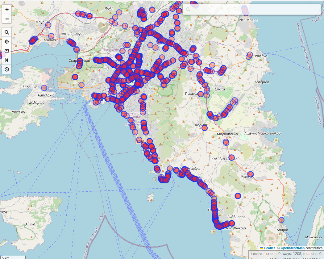
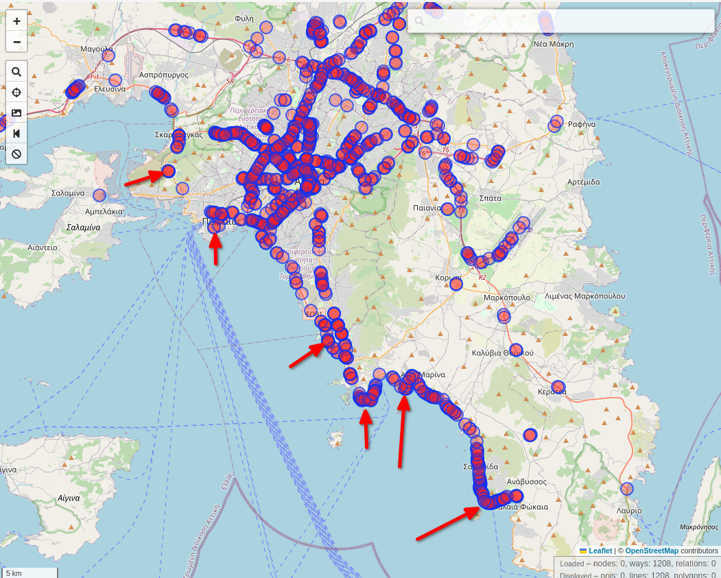
We look at the name of the way (kindly added by the one that input this way on OSM) and find the following :